 姉妹都市パースの地質
オーストラリアのパース(Perth)市は鹿児島市と昭和49(1974)年4月23日姉妹都市の盟約を結びました。その理由は、鹿児島市のホームページによると次の通りです。パース市は南緯32度に位置し「ひかりの街」と呼ばれるのに対し、北緯32度に位置し「太陽と緑の街」と呼ばれる鹿児島市とは地理的、気候的に共通点が多く、民間団体の親善訪問が盛んになりました。こうした交流が盛り上がる中、姉妹都市盟約が結ばれました。
さて、地質的に見るとパースと鹿児島は全く異なります。そもそも日本列島は新しい島弧なのに対し、オーストラリアは先カンブリア紀の古い安定陸塊(Craton)です。パースは、その南西端に位置する西オーストラリアの州都です。 | オーストラリア地質図(Geoscience Australiaによる)( :Perth Town Hall) :Perth Town Hall) |
文献:
- Harris, L. B. (1994), Structural and Tectonic Synthesis for the Perth Basin, Western Australia. Jour. Petroleum Geol., Vol.17, Issue 2, p.129-156.
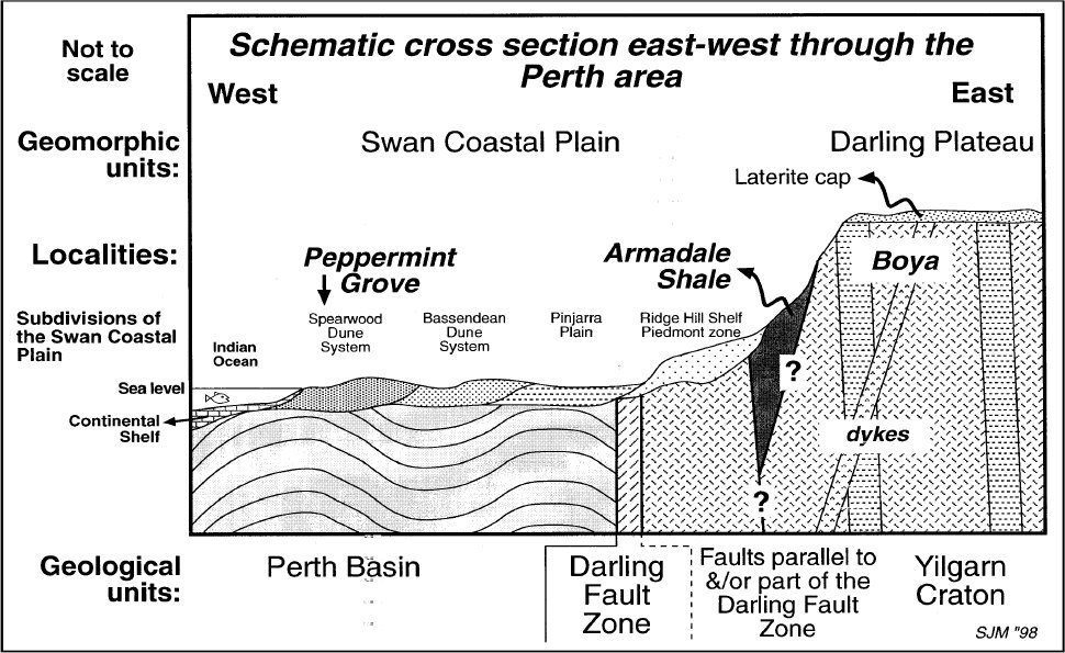
- Moss, S. J. et. al.(1998), The Prider Field Trip – the rock cycle and geology of the Perth metropolitan area. Geological Society of Australia (W.A. Division), 47pp.
- Web Page of Geoscience Australia Applying geoscience to Australia's most important challenges - Perth Basin
- McPherson and Jones, A. (2005), Appendix D: Perth Basin Geology Review and Site Class Assessment. Natural hazard risk in Perth, Western Australia, p.313-344.

初出日:2015/06/23
更新日:2020/03/14